Mean High Tide Line Explained in Dana Point
January 22, 2026
January 22, 2026
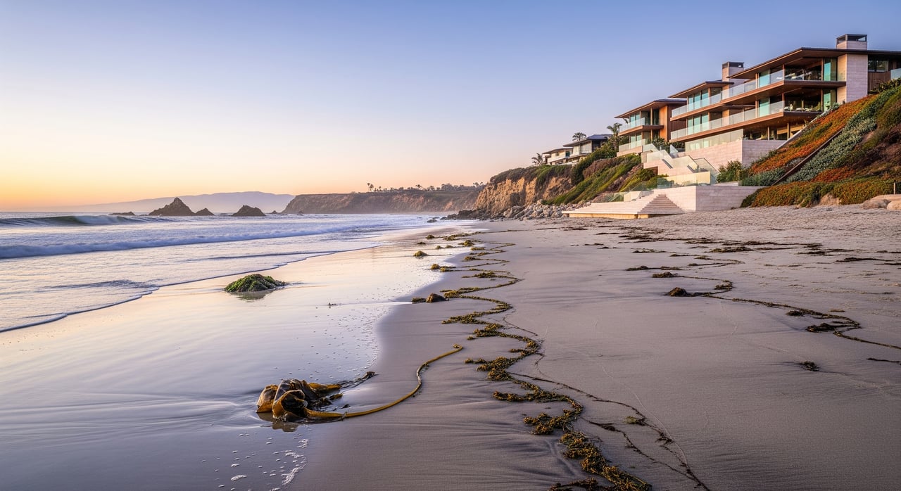
Is the sand in front of your Dana Point home private or public? The answer starts with the mean high tide line, a technical shoreline boundary that carries very real consequences for access, permitting, and long-term value. If you are buying, selling, or owning along our bluffs and beaches, you want clarity. In this guide, you will learn what the mean high tide line means in California, how it is determined, and the steps to verify it for a specific property in Dana Point. Let’s dive in.
The mean high tide line, often called mean high water, is the statistical average of successive high tides over a defined time period. It is used in California to identify the ordinary high tide position for mapping and legal purposes. You may also see mean higher high water in technical products. That is a different tidal datum, but mean high tide line is the common legal concept for beach boundaries in the state.
This boundary is ambulatory, which means it can move with natural accretion and erosion over time. If the shoreline gradually shifts, the legal line can shift with it. There is also a difference between the legal line and what you see on the beach on any given day. The visible wet or wrack line can vary with storms and tides. Legal effects depend on the mapped or legally established mean high tide line, not a temporary wet line.
In California, land seaward of the recognized mean high tide line is generally held by the State of California in trust for public uses such as navigation, fishing, and recreation. This is often called the public trust doctrine. The state’s authority is administered through agencies and courts and applies along Dana Point’s shoreline.
Most property landward of the mean high tide line is private, but it can be subject to access easements and coastal permitting requirements. In Dana Point, public trust tidelands intersect with local jurisdictions that manage beaches and harbor operations. Doheny State Beach is managed by California State Parks, and Dana Point Harbor operations are managed by Orange County Harbors, Beaches and Parks. The California Coastal Commission and the City of Dana Point Planning Department implement coastal rules that protect access and guide development in the coastal zone.
Agencies such as NOAA create tidal datums by analyzing long-term tide gauge records for a defined epoch. California agencies and surveyors convert these datums into mapped positions of the mean high tide line using shoreline imagery, field evidence, and professional judgment.
For a legal boundary on a parcel, you typically need a survey by a California licensed land surveyor with coastal and tidal expertise. That survey should reference the applicable tidal datum and describe how the line was located. State Lands Commission mapping, local planning GIS layers, aerial imagery, and LIDAR can help illustrate shoreline features such as the bluff toe and high-tide wrack lines. Expect some variation between datasets because mapping the mean high tide line is an interpretive exercise.
If a deed says ownership extends to the mean high tide line, that language is not definitive without a survey and review of state records. Title reports often include exceptions for tidelands or public trust interests. You should assume these exceptions matter until proven otherwise through professional due diligence.
Public access generally applies seaward of the mean high tide line. Private stairs, bluff paths, or fences do not automatically create a private beach. Recorded easements and prior permits can control who uses stairs and how. Always verify recorded rights and any conditions tied to earlier coastal permits.
Projects near the shoreline often require Coastal Development Permits. This includes new structures, significant remodels, bluff stabilization, seawalls, bulkheads, and stairs. Local coastal policies may require setbacks tied to the bluff edge or slope stability, not just the tidal boundary. The City of Dana Point, the California Coastal Commission, and other agencies can be involved depending on location and the status of the local coastal program.
Storms and rising seas can narrow beaches and push the mean high tide line inland over time. This affects future access, permitting, and potentially financing and insurance. Lenders, insurers, and regulators increasingly expect coastal hazard and geotechnical assessments for bluff-adjacent sites.
You are typically responsible for maintaining structures landward of the mean high tide line. Work that affects public tidelands or access seaward of the line is tightly regulated. Maintenance and repairs may require permits and sometimes mitigation.
Use this practical checklist to confirm boundaries and constraints:
Many Dana Point neighborhoods sit atop coastal bluffs. Here, setbacks often relate to the bluff edge and geotechnical stability. Private stairs and bluff stabilization are common topics and can trigger coastal permits and conditions.
Homes near Doheny State Beach interact with state park management and public access. The mean high tide line and any recorded easements help define how public use meets private ownership. Expect heightened attention to access and visitor circulation.
Dana Point Harbor is managed by the county, and its infrastructure shapes local tidelands and access plans. Projects near the harbor can involve multiple agencies and careful coordination.
If you are evaluating an oceanfront or bluff-adjacent property in Dana Point, you deserve precise answers and a smooth process. For a private consultation and a curated plan tailored to your goals, connect with Kira Nimmer-Crabel.
Stay up to date on the latest real estate trends.


California Real estate specialist. With years of experience and a track record of success, we are here to exceed your expectations. Contact Kira today so she can guide you through the buying and selling process.
Get In Touch With Kira

341 Bayside Dr
Newport Beach, CA 92660